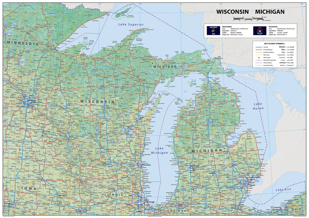
Wisconsin & Michigan Physical State Map
Explore Wisconsin and Michigan with this informative US State Map. Wisconsin borders Minnesota, Iowa, and Illinois. Michigan, with its land borders to Indiana and Ohio, and connecting lakes, features Detroit, Grand Rapids, Ann Arbor, and the state capital, Lansing. Major cities in Wisconsin, like Milwaukee, Green Bay, and Kenosha, are shown, as well as Madison, the state capital. You'll be able to explore the Midwest in full and maybe find the perfect spot for your next adventure and discover the charm of the Midwest for yourself.
This physical map presents key information such as the capital cities, population, area size, and largest city, plus locations of airports, major highways, state boundaries, and populated areas. In addition, the map includes bodies of water and points of interest such as national and state parks, forests, cultural sites, and more.
Laminated option: Printed onto high quality poster paper and laminated for durability.