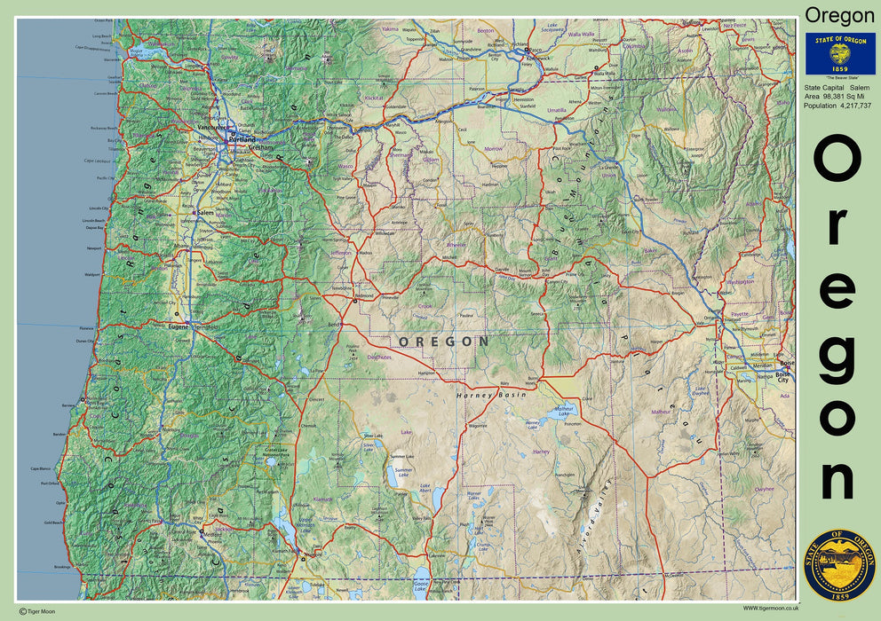
Oregon State Physical Map
Featuring the capital city of Salem and the cities of Portland, Eugene, Gresham, and Hillsboro. Rivers such as the Columbia delineate much of Oregon's northern boundary with Washington, while the Snake River marks a large part of its eastern boundary with Idaho. Take in the vista of Mount Hood and enjoy the Crater Lake National Park.
This physical map presents key information such as the capital cities, population, area size, and largest city, plus locations of airports, major highways, state boundaries, and populated areas. In addition, the map includes bodies of water and points of interest such as national and state parks, forests, cultural sites, and more.
Laminated option: Printed onto high quality poster paper and laminated for durability.