Skip to content
Search
Login
Cart
Home
All Products
The Oxford Collection
Wall Maps
Europe Maps
Physical Maps
Political Maps
Road Maps
Illustrated Maps
County Maps
Satellite
Street Maps
USA State Maps
London Maps
Post War London
London Boroughs
Historical London
1872 London Maps
Out to the M25
Historical Maps
Antique Maps
1870 Collection
1890 Collection
1920 Collection
Historical Maps
Gifts
Cancel
My account
Home
All Products
The Oxford Collection
Wall Maps
Wall Maps
Europe Maps
Physical Maps
Political Maps
Road Maps
Illustrated Maps
County Maps
Satellite
Street Maps
USA State Maps
London Maps
London Maps
Post War London
London Boroughs
Historical London
1872 London Maps
Out to the M25
Historical Maps
Historical Maps
Antique Maps
1870 Collection
1890 Collection
1920 Collection
Historical Maps
Gifts
Home
/
Products
/
Children's World Double Sided Map A2-59cm x 42cm - Paper Laminated
Children's World Double Sided Map A2-59cm x 42cm - Paper Laminated
£5.49
£9.99
|
/
Quantity
In stock
Add to Cart
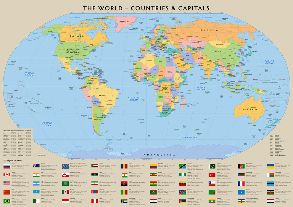
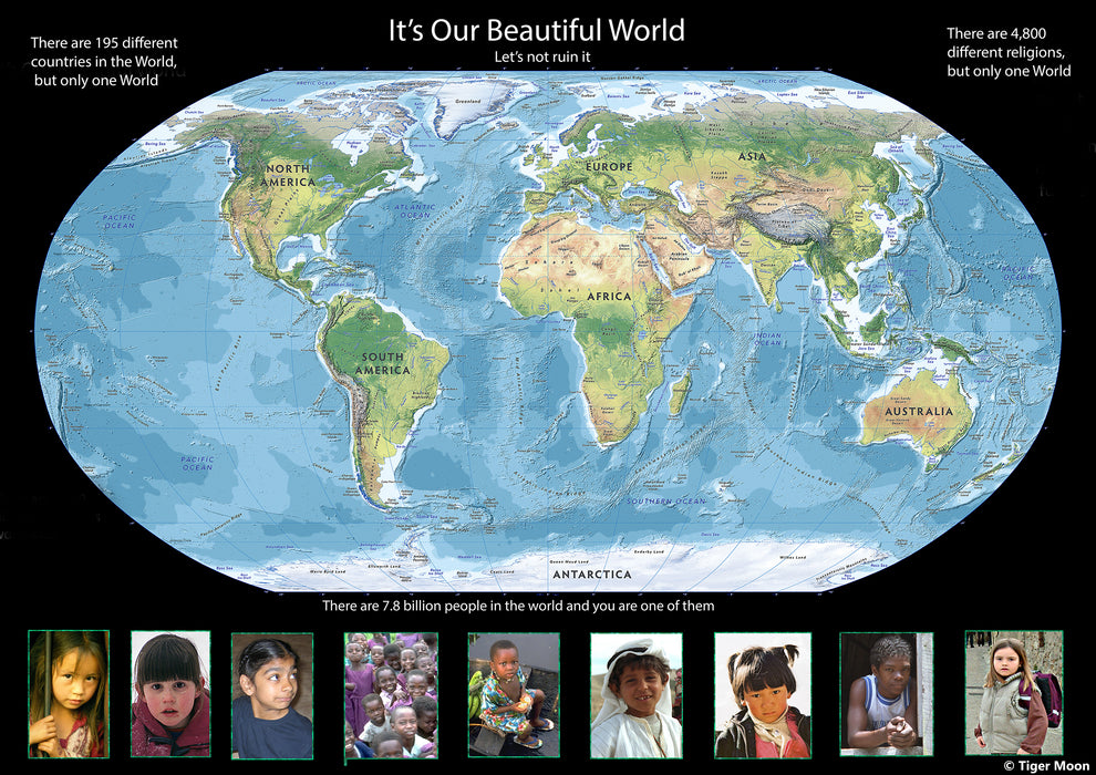
Children's World Double Sided Map - Paper Laminated
One side - The World - Countries and Capitals, All countries detailed with different vibrant colours, clean and concise for children in an education setting.
Other Side - It's Our Beautiful World, Promoting Diversity and Religion
All the flags of the world, with population and capital information
Map is A2 - 59cm x 42cm - Paper Laminated for durability.